
OlmoEarth v1.3 Released with Global Satellite Embeddings
OlmoEarth v1.3 introduces state-of-the-art satellite embedding models, providing precomputed annual global data and open-source tools for environmental analysis.
 Radwan AbdulhadiEditor and technology writer
Introduction to OlmoEarth v1.3
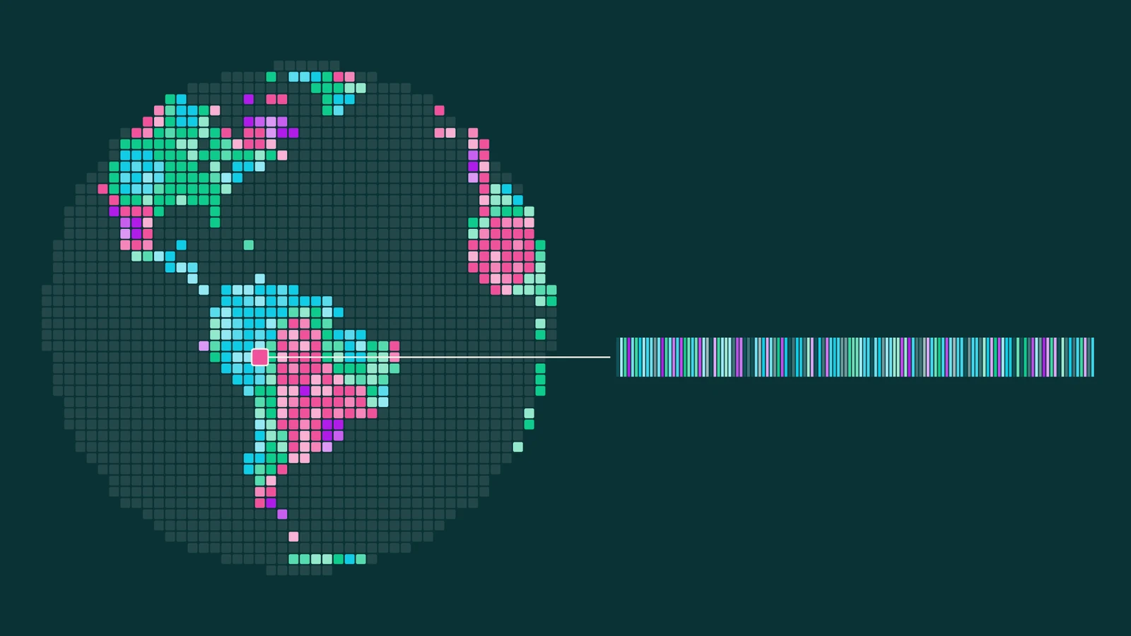
The release of OlmoEarth v1.3 introduces state-of-the-art satellite embedding capabilities to the global community. Along with the core model, the project shares precomputed, annual embeddings covering the entire planet in 10-meter resolution across 64- and 128-dimensions. Detailed information is available through the official [Hugging Face Blog](https://huggingface.co/blog/allenai/olmoearth-v1-3).
Traditionally, utilizing models like OlmoEarth required intensive fine-tuning within dedicated studios, demanding substantial GPU access and local storage for imagery. Embedding models solve this hurdle by compressing raw satellite data into ready-to-use features that can be deployed efficiently across diverse tasks without requiring advanced technical infrastructure or sign-ins.
Model Architecture and Technical Approach
OlmoEarth v1.3 processes a full year of radar data via Sentinel-1 alongside multispectral observations from Sentinel-2 and Landsat. It generates a single 128-dimensional vector for every 10-meter pixel on Earth, with the first 64 dimensions functioning independently as a lighter embedding. Further specifications and architecture details are accessible via the [Tech Report](https://allenai.org/papers/olmoearth-v1-3).
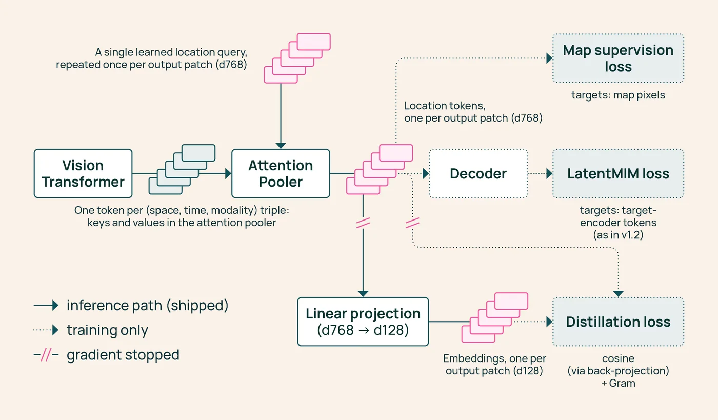
The underlying architecture utilizes a vision transformer to read satellite data, an Attention Pooler to consolidate it into a single vector per land patch, and a linear layer that reduces the output to 128 numerical values. This approach significantly lowers computational overhead.
Open Accessibility and Resource Availability
Foundation models and global embeddings are traditionally expensive to produce and maintain. To democratize access, the precomputed embeddings for the entire planet have been shared with the broader research and development community via [Data](https://source.coop/olmoearth/olmoearth-v1-3-embeddings).
By distributing these resources openly, tasks such as crop mapping, land-cover analysis, and environmental change detection transition from heavy computational tasks to lightweight local modeling problems. Developers can retrieve the complete model weights, pretraining code, and data archives directly.
Performance and Comparative Evaluations
The development team evaluated OlmoEarth v1.3 against alternatives like AlphaEarth Foundations and Tessera v2 across 27 distinct evaluations spanning six continents. The 128-dimensional embeddings achieved the highest scores on 20 out of 27 evaluations, securing the top overall ranking, while the 64-dimensional variant led on 18 evaluations.
This release also introduces PLANTEUR, a novel crop-type benchmark tailored for tropical farming environments. The underlying architecture and model weights are fully documented in the repository under the [Models](https://huggingface.co/allenai/OlmoEarth-v1_3-Base/) section.
Efficiency and Training Costs
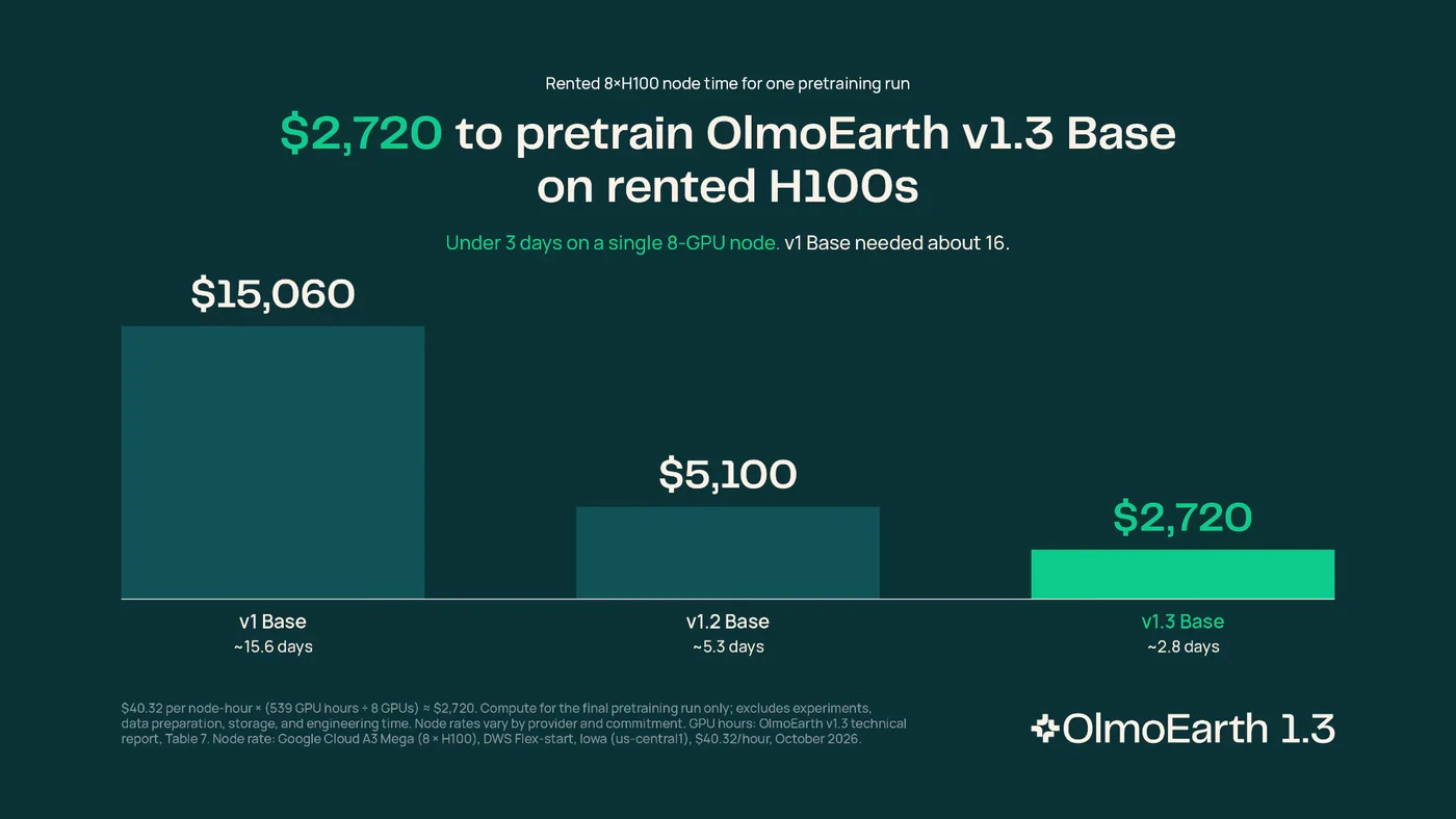
OlmoEarth v1.3 represents the most cost-effective training cycle for the project to date, consuming approximately 53% of the computing time required for version 1.2 and only 18% of the initial version. This efficiency resulted in corresponding reductions in carbon emissions.
Reproducing the pretraining phase for the OlmoEarth v1.3 Base model requires roughly $2,720 in rented H100 computing time. All associated instructions, source codes, and pretraining routines are available in the repository at [Code](https://github.com/allenai/olmoearth_pretrain).
Interactive Exploration Tools
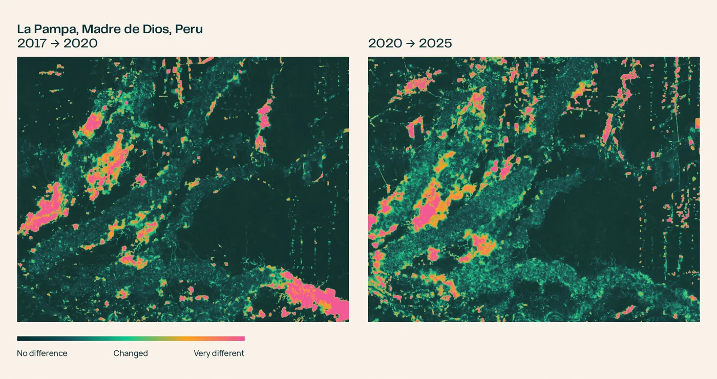
To enable immediate practical application, the platform includes a dedicated browser-based interface. Users can inspect maps, track landscape transitions over time, and compare changes across years using the [Embeddings Explorer](https://olmoearth.allenai.org/embeddings).
The explorer allows analysts to pan across regions, switch between historical years, and verify false-color embedding maps against real underlying Sentinel-2 imagery. Teams can train lightweight classifiers on the spot using a handful of user-labeled points without requiring dedicated GPU infrastructure.
Sources
- Hugging Face BlogOlmoEarth v1.3: State-of-the-art embeddings for the whole planet
Continue chronologically


Related stories
Olmo-core 3 Released for Open MoE Training
Discover Olmo-core 3, the open and scalable training infrastructure designed for large Mixture-of-Experts models up to the trillion-parameter scale.

Ai2 Overhauls GPU Cluster Scheduler for AI Research
Ai2 updates its GPU cluster scheduling framework, introducing time budgets and hierarchical fair-share allocation to maximize impact and occupancy.
NVIDIA Expands Nemotron 3.5 with New Retrieval Models
NVIDIA expands its Nemotron collection with open models for embedding, reranking, and document parsing to enhance enterprise agent workflows.

StateBench Released to Test Long-Document State Tracking
A new benchmark evaluates how well language models track changing entity states across long documents, revealing limitations in current architectures.