
Amazon QuickSight Layer Maps Gain Point and Line Support
Amazon QuickSight layer maps have been updated to support Point and LineString geometry from the same GeoJSON workflow, allowing businesses to plot individual locations and the pathways connecting them.
 Radwan AbdulhadiEditor and technology writer
Expanded Geometry Support in Layer Maps
According to the AWS Machine Learning Blog, Amazon QuickSight layer maps now support Point and LineString geometry within the same GeoJSON workflow. When layer maps first launched, users could upload a GeoJSON file to draw custom shape layers like sales territories or districts and join those shapes to a dataset, but the capability did not cover individual locations or routes.
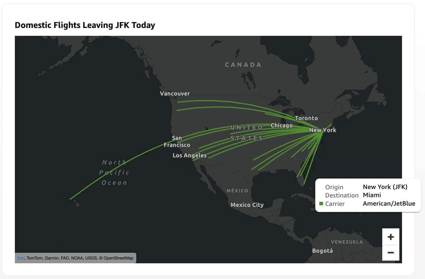
The updated feature allows businesses to visualize patterns tied to location, such as store locations across a city or flights leaving an airport. Quick Sight provides multiple map types to support these geospatial analyses, including point maps, filled maps, and layer maps.
Understanding Points and LineStrings
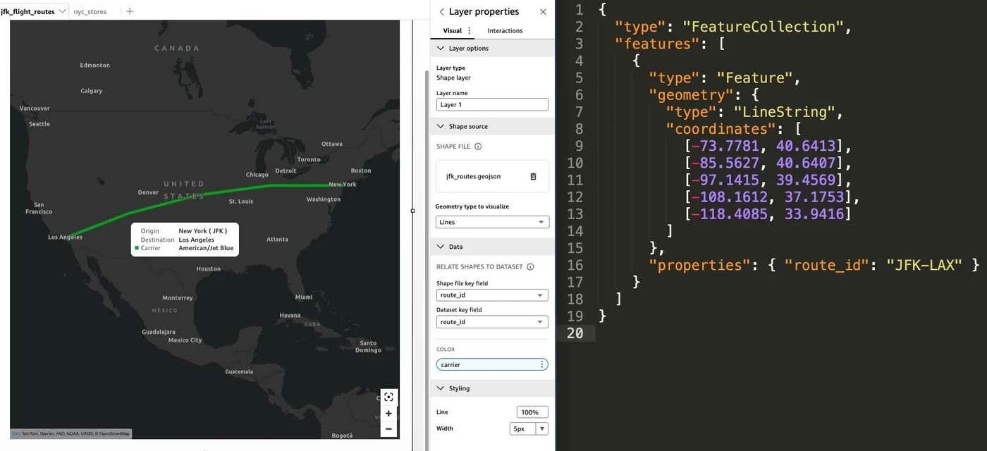
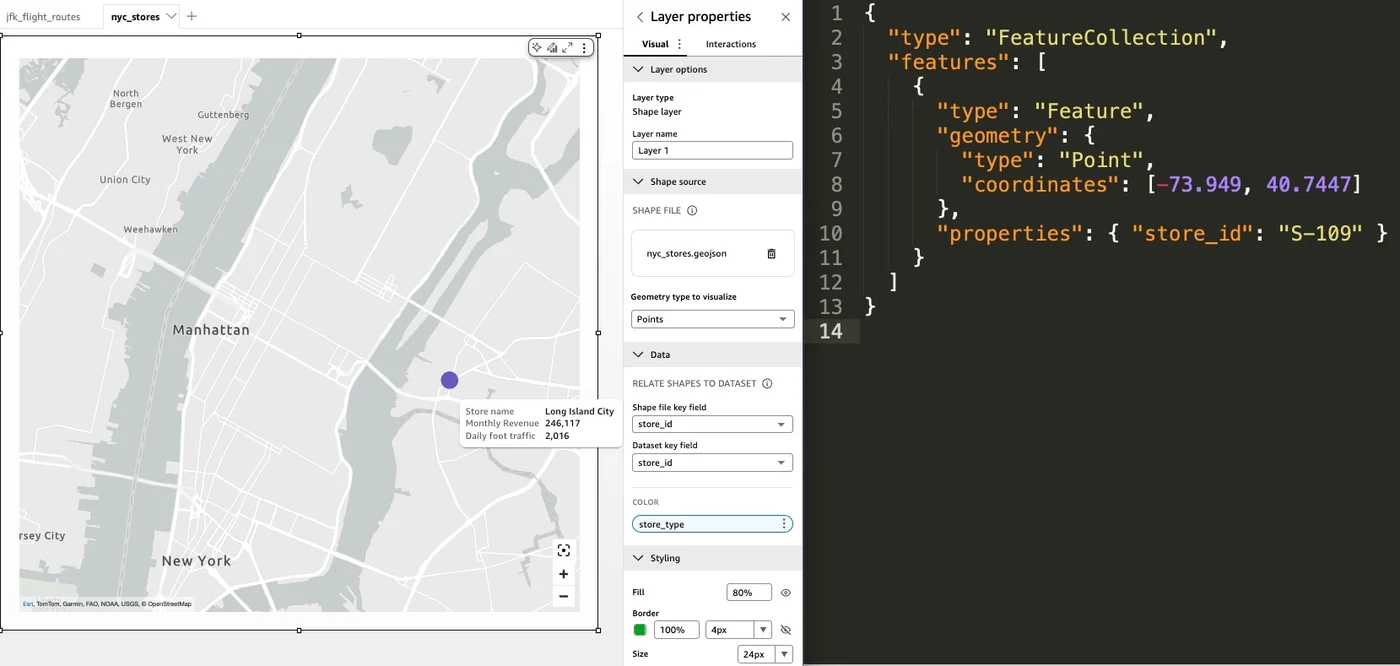
The newly supported geometry types serve distinct purposes in spatial analysis. Points mark specific locations such as individual store or facility sites, while a LineString traces a route between locations, like a delivery path or a flight trajectory between airports.
LineString geometry connects an ordered list of coordinates into a single path. Each route operates as one feature where coordinates are connected in sequence. Organizations can use lines when the relationship between locations is the primary focus, such as shipping lanes, flight paths, or pipeline segments.
Prerequisites and GeoJSON Structure
Configuring a layer map requires a Quick Sight dataset holding metrics and dimensions, a shared join key between the dataset and the GeoJSON file, and a valid .geojson file format with a maximum supported file size of 100 MB. GeoJSON is a JSON-based format utilized for describing geographic features.
A FeatureCollection represents the entire file containing a features array, whereas a Feature represents a single map element carrying geometry and a properties object that holds the join key. Geometry objects specify a type such as Point, LineString, or Polygon along with coordinates.
Dataset Integration and Visualization Settings
When configuring a layer in a layer map visual within Amazon QuickSight, administrators evaluate two primary settings. The first setting determines the Geometry type to visualize, setting whether Points, Lines, or Polygons render on the map. The second setting matches the shape file key field to the dataset key field, successfully linking each GeoJSON feature to a specific row in the dataset.
For line layers, fields from the joined dataset can dictate line color encoding to group routes accordingly. Additionally, users can customize lines with width and opacity controls to refine visual prominence and clarity.
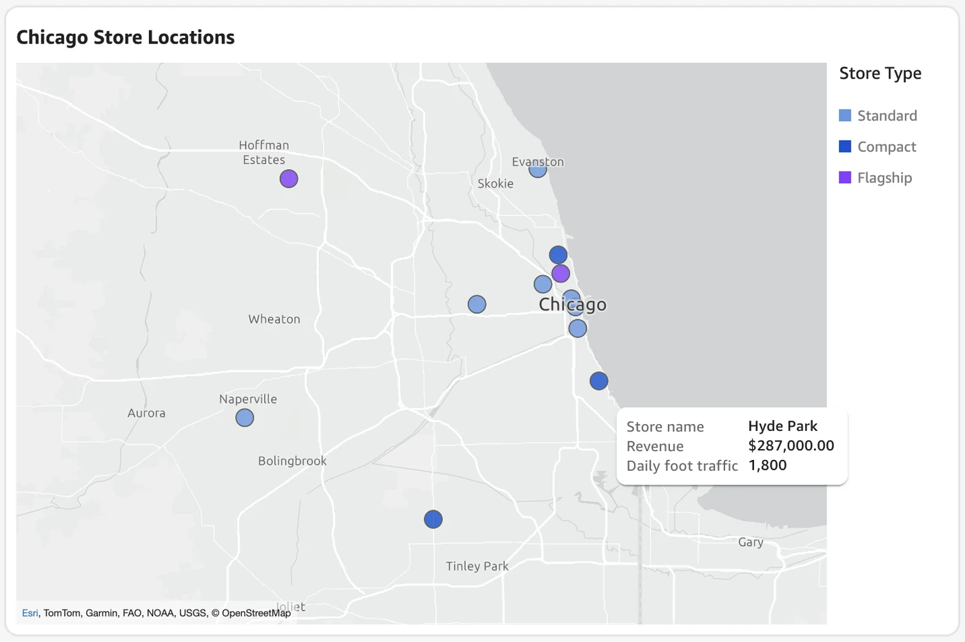
Comparing Point Visualizations in Quick Sight
Amazon Quick Sight offers a native point map visual type that automatically geocodes location names and refreshes with scheduled data. However, the newly added support for GeoJSON point layers in layer map visuals offers a distinct alternative.
Layer map visual points utilize a uniform marker size and do not support automated geocoding, requiring explicit coordinates within the GeoJSON file instead. In exchange, users gain precise viewport control, allowing them to lock the map to exact geographic regions and disable panning and zooming when fixed locations are required.
Sources
- AWS Machine Learning BlogVisualize points and routes with GeoJSON in Amazon Quick Sight layer maps
Continue chronologically


Related entity coverage
Related stories
Amazon QuickSight Introduces New Hierarchy Filter Feature
Amazon QuickSight has launched a new hierarchy filter feature, enabling multi-level dashboard filtering in a single compact control.
Amazon and Synopsys Sign Multi-Year AI Chip Deal
Amazon and Synopsys have inked a multi-year, billion-dollar partnership to accelerate AI chip design using advanced EDA tools and AWS services.

AWS Launches Amazon Connect Talent to Accelerate Hiring
Amazon debuts Amazon Connect Talent, an AI-powered solution designed to help recruitment teams automate interviews and streamline high-volume hiring.
AWS Details Component Patterns for Amazon Quick Prompting
Discover component-specific prompt engineering patterns and pitfalls for Amazon Quick Research, Quick Flows, Quick Sight, and chat agents.